Information Management/Geomatics
Certes has been providing comprehensive information management and geographic information systems (GIS) services to clients throughout Western Canada since 1999. Certes’ GIS team consists of 4 trained individuals, all with unique experiences and skill sets with combined experience of over 40 years in spatial management. Certes supports these individuals with ongoing training as well continual integration of new and emerging software.
We have taken a best of breed approach to the tools we use to work within our expertise. Not restricting ourselves to specific vendors, we have sought the right tools to deliver the optimal product for our clients. We have extensive experience with ESRI, Autodesk and numerous open source products and have the confidence to develop in all these environments. We are always looking out for the best technologies available and we are able to provide GIS functionality across the internet to clients or the public through web mapping and web GIS.
The basis and strength of our GIS expertise is to collect, store, analyze, manage and present geographically linked data. By developing spatially specific data for each project, we are able to efficiently identify the strengths, challenges and gaps of the current state of each dataset and present spatially linked solutions. Well-categorized, searchable spatial databases of information become a valuable asset for ongoing and future projects or studies for our clients. In addition, the ability to organize and present a vast amount of information in an easy to understand geographically associated manner gives clients and other stakeholders the information needed to make informed decisions.
Key Services
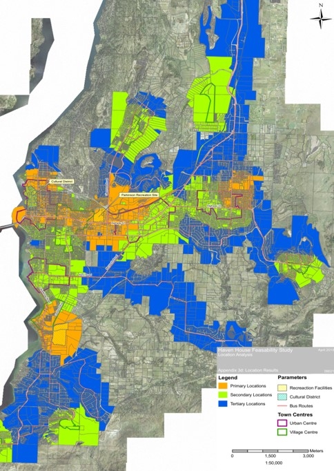
- Spatial analysis
- Integrated visual design planning
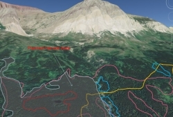
- Terrain modelling
- Spatial data compilation and management
- Data inventory
- Creating & maintaining large spatial/aspatial data sets
- Data loading
- Data assessment and quality control
- Web-based mapping
- Custom web GIS analysis
- Querying geodata in a browsers
- Custom web design around maps
- Software development
- Detailed design specification
- Detailed documentation
- Training/support services